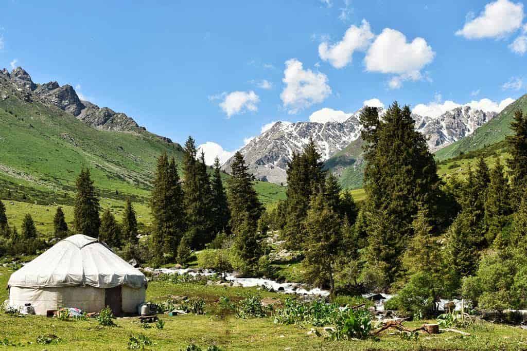
I spent 3 summers living and working in Jyrgalan and personally have walked every single trail in the valley. Here’s my guide to the best day hikes from Jyrgalan.
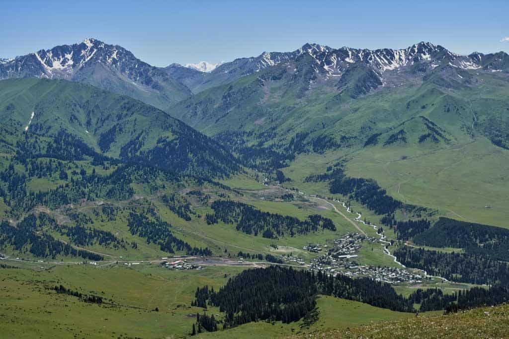
Jyrgalan is a small village in the far east of Kyrgyzstan, at the foot of the Tian Shan Mountain range.
During Soviet times the village was very prosperous due to its coal mine, which provided many jobs to the local population.
While some of the locals still affectionately refer to the village as “Shaktar” (Russian word for “mine”), the mine has been closed since the fall of the Soviet Union, causing many to abandon the village in search of new work.
Today Jyrgalan is a sleepy village, full of charm and friendly welcoming people. The kind of place people go to spend a few days and end up staying a week.
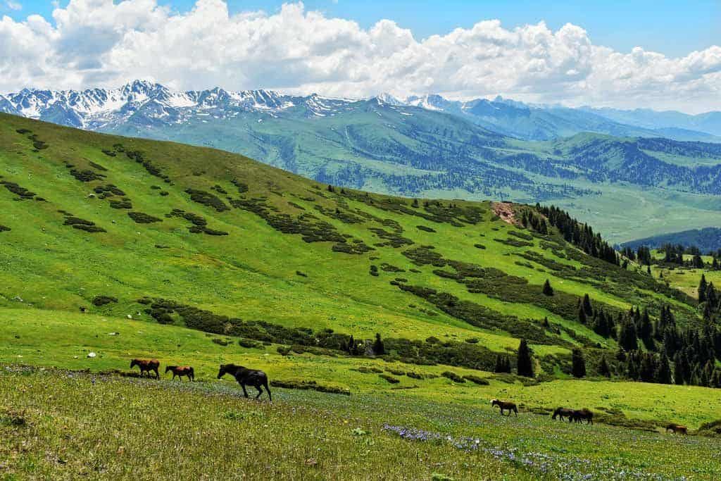
Surrounded by mountains and spectacular valleys, it’s not surprising this village has became a hidden gem for those looking for outdoor activities (trekking, mountain biking, horse riding, and skiing).
Jyrgalan has developed a reputation for offering some of the best multi-day treks in Kyrgyzstan, including the Keskenkija Loop, Boz-Uchuk Lakes, and most recently Bulak-Ashuu Lakes.
The Best Jyrgalan Day Hikes
Fortunately for those without the time or inclination for a multi-day trek, the village offers a number of beautifully scenic one-day hikes suitable for all abilities.
These Jyrgalan day hikes are also excellent for acclimatising prior to tackling some of the high-altitude treks in the area.
READ MORE: Check out our comprehensive guide to travelling to Kyrgyzstan!
Char Jon Panorama
- Distance: 16km (approx 6-7 hours)
- Altitude gain/loss: 800m
Char Jon is the peak to the north of Jyrgalan. While it’s a reasonably strenuous hike up it offers one of the best views in the local area.
It is the perfect choice for those looking for one of the more challenging Jyrgalan day hikes.
This trek starts from the upper section of the Jyrgalan Village.
From the houses here you will see a ridge with some electricity poles going up towards a small building (cell tower).
Head up the ridge, which after an initial climb eases to a more gentle walk along undulating hills.
Keep going along the ridge past the cell tower and you eventually come to a final steeper section.
After around 150m climbing this steep section flattens out, congratulations you have reached the summit!
At the peak you will have 360-degree panoramic views. To the north, you will see over into Kazakhstan.
To the east is Kok Bel pass and Black Nose Peak. To the south, Jyrgalan Valley and village.
If the weather is very clear you can even see Issyk Kul on the horizon to the west.
From the peak, the quickest way back to Jyrgalan village is via the ridge you came up.
However, a more scenic and enjoyable route is to descend via a small lake called Turnaluu Kol.
From the peak head down along the ridge to the north.
The lake is to the east, but hidden behind some trees and will only come into view once you get a little further down the ridge.
You are aiming for the trail going through the parting in the trees to the lake.
NOMADasaurus Note: One of our readers Lena has pointed out the following directions to us: When I was standing at the summit, I noticed your article suggests heading down north and that the lake will be to the east. However, I downloaded a compass for this hike beforehand and noticed that actually you need to head down towards the west and then you’ll already be able to see the lake (which is also to the west).
There are many possible routes down to the lake from the ridge.
The most direct route is often very wet and boggy, particularly in the early part of the trekking season.
It is often more comfortable, although slightly longer, to take the trail looping around to the right.
At the west end of the lake, you will find some big logs that can be used as benches.
This makes a nice place to stop for lunch (better than the peak which can be a little uncomfortable due to wind).
From this picnic area continue along the trails going away from the lake.
These trails work their way back to the village, and some red arrows have been painted on rocks and trees to help direct you.
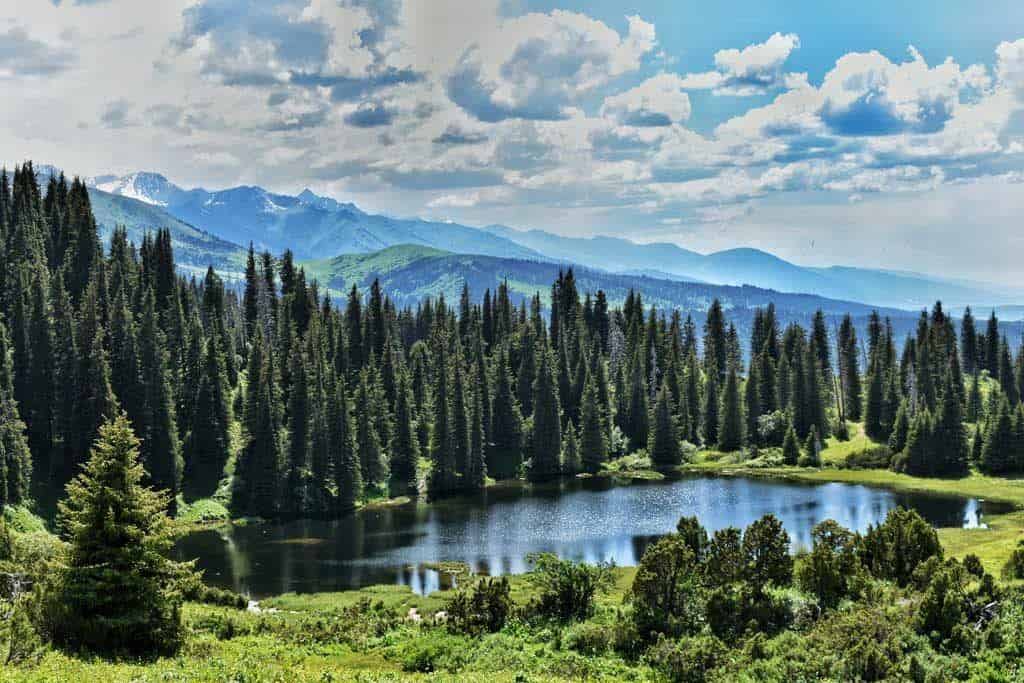
Turnaluu Kol
- Distance: 11km (approximately 4-5 hours)
- Altitude gain/loss: 4500m
While we recommend combining Turnaluu Kol with Char Jon Panorama for the best day hiking experience, if you are looking for a shorter and easier hike it is possible to just visit the lake.
From the school take the road heading out the village toward the main road.
Cross over the bridge and go up to the road and turn left.
After around 30m walking on the road take the trails on your right going away from the village in a north-easterly direction.
Follow the trails, gradually gaining elevation. Look out for red arrows that have been painted on rocks and trees to mark the route.
Many shepherds bring their animals to graze in this area so you will probably see horses, sheep, and goats.
Eventually, after around 3 hours, you will reach Turnaluu Kol which translates as “Crane Lake”, named after the birds that migrate through this area each spring.
While the best opportunities to see the cranes are in Spring, sometimes they can be still be seen in July.
Other birds, including eagles, can be seen at any time.
It is worth continuing along the trail to the east end of the lake. Here the trail rises a little providing a nice viewpoint.
If you want to eat lunch at the lake there are some logs at the west end of the lake which can be used as benches.
Return to Jyrgalan via the same route taken to the lake.
Eki-Chat Yurt Camp
- Distance: 14km (approximately 5 hours)
- Altitude gain/loss: 500m
Eki-Chat yurt camp is the best Jyrgalan day hike for those looking to see Kyrgyz culture and experience the beautiful Jyrgalan Valley.
Be aware that this route is the same as the first 1/2 day of most of the multi-day treks, so if you plan to do one of them you should probably pick one of the other day hikes from Jyrgalan.
The trek begins at the southern end of Jyrgalan village.
Cross the bridge over to the east side of the Jyrgalan River and take the steep dirt trails heading up towards the electricity pylon.
From these trails, you will be able to see a wooden stage used for J-Fest, the annual summer festival held each August in Jyrgalan.
Near to the stage, you can make out two large black stacks of tractor tyres.
These tyres form the Kazan (goals) for Kok-Boru, the traditional Kyrgyz horse sport played with a headless goat carcass.
At the top of the trails you can see a big rock to the south. This rock is named Tulpar Tash (Horse Rock).
This rock is famous due to being mentioned in the legendary story of the Kyrgyz hero, Manas.
There is little traffic on this road. It is mainly just used for transporting yurts to and from the jailoos (high pasture areas) at the beginning and end of summer.
Occasionally the local milk truck uses this track to bring kumys – the popular Kyrgyz drink of fermented mare’s milk – down to sell in the village.
After 7km walking from Jyrgalan, you will reach Eki-Chat, a small jailoo with a collection of yurts.
Here you can relax watching traditional nomadic life and enjoying the beautiful scenery.
If you are lucky you might be invited into a yurt for some tea and kumys.
This yurt camp is the final point of the trek and most people turn around here.
However, if you arrive early and would like a longer trek you can continue further up the Jyrgalan Valley.
Just cross the bridge and continuing along the jeep track, turning around when you get tired.
Return via the same route you came.
It is possible to come off the jeep track and follow horse tracks next to the river, however these can be very wet and boggy so if in doubt stay on the track.
After passing Tulpar Tash head towards the electricity pylon.
Below this pylon is the steep dirt trails you began the day on.
Be careful, if the weather has been wet these trails can be slippery, and a better option is to continue on the jeep road which will take you a slightly longer, but flatter, and more comfortable route back to the village.
READ MORE: Check out our guide to the best tips for hikers here.
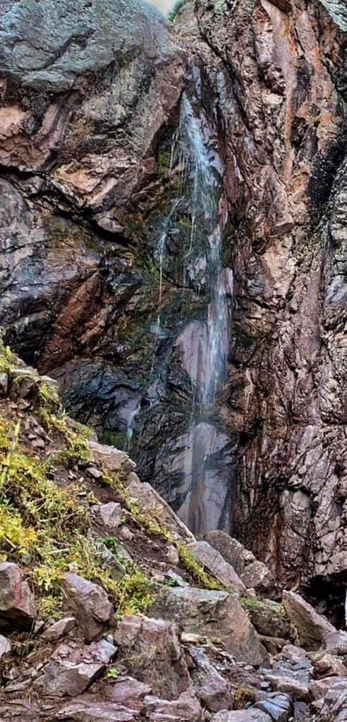
Kok-Bel Waterfall
- Distance: 12km (approximately 3.5-4 hours)
- Altitude gain/loss: 450m
This is perhaps the easiest Jyrgalan day hike. The route is well marked and easy to follow, and there is little uphill with no steep sections.
Be careful if using maps.me as there are two Kok-Bel waterfalls on the map. The correct one is east of the village.
To get to the waterfall take the main road heading out of Jyrgalan.
After seeing the “Welcome to Jyrgalan” sign and crossing the river take the road to the right heading east.
From here you will have a good view of the old coal mine.
This mine was an important source of coal during the Soviet times, when approximately 5000 people lived in Jyrgalan, but has not been in use since.
Keep following the road, which eventually crosses back across the river, and into a small valley with another coal mine.
The coal mine here is still in use today, operated as a very small scale operation by a few of the villagers.
After passing the mine the road begins to fade. Continue along the right side of the river, picking the most obvious trail.
As you continue along the river the valley narrows into a canyon and the surface becomes rockier.
At some points it’s necessary to cross the river, which is easily done, to get on better trails.
Continue up the canyon until you reach the waterfall.
The waterfall is 20m high, making it the biggest in the local area.
It’s possible to go all the way to the base of the waterfall, however the very last section requires some very easy scrambling.
Be aware that this waterfall is seasonal, and by the end of August may be dry.
You can check current conditions in the Destination Jyrgalan Office prior to setting off.
Day Hikes from Jyrgalan – Tips and Information
Here’s a bit more information to help you plan your travels and hiking in Jyrgalan village.
How Do I Get to Jyrgalan?
Marshrutka number 331 leaves 3 times per day from Ak-Tilek Bazaar in Karakol (08:30, 11:30, and 17:30).
It is best to arrive around 30mins prior to departure as the bus is usually full, with those arriving later having to stand.
Marshrutka number 331 returns to Karakol from Jyrgalan at 07:30, 11:30, and 16:30.
The journey takes approximately 1.45 hours in each direction and costs 90-150som depending on the size of the luggage.
A taxi costs around $25 each way and takes around 1.15 hours.
Accommodation in Jyrgalan
It is possible to do any of the treks in this article as a day trip from Karakol.
You will need to take the first marshrutka from Karakol, giving you around 6 hours to complete the hike before the last marshrutka returning to Karakol departs.
For a more relaxed experience, or for those looking to do more than one hike, there is a range of accommodation.
Prices and availability of all the accommodation can be found on the Booking.com website, which can also be used to make reservations.
There is no café or restaurant in the village, just a few small shops selling some basic things.
Any guesthouse in the village can prepare hot meals or lunchboxes but might need an hour or two notice.
There is no ATM, so you need to bring cash (Kyrgyz Som, Euros, USD). For larger transactions Destination Jyrgalan can accept card payments
Independent vs Guided Hikes
All of the Jyrgalan day hikes in this article can be completed independently.
While some of the hikes have small sections without a clear trail, generally route-finding is straight forward, and there are some painted arrows marking the way.
If you would prefer to complete the hike with a guide you can arrange this through Destination Jyrgalan (destination.jyrgalan@gmail.com).
Horse Trekking in Jyrgalan
Except for the Kok Bel waterfall hike, these routes can also be done on horseback.
To organise horse riding contact Destination Jyrgalan at least 24 hours in advance.
What Do I Need for the Day Hikes in Jyrgalan?
There are no permits or technical equipment needed for any of these particular treks in Jyrgalan.
However, a few things are recommended:
Suitable footwear (e.g. walking boots or trail running shoes)
- Sunscreen and sunglasses
- Water
- Food/snacks
- Waterproof jacket/trousers
- Map (either electronic or paper copy).
When to Go to Jyrgalan
These hikes are usually done from June to September, with the weather being most consistently warm and dry in July and August.
The hikes can be done in winter using snowshoes, which can be rented in Jyrgalan.
Temperatures below 0 degrees Celsius are common, so suitable clothing for very cold weather is necessary.
As trails are covered by snow, it is best to take a guide to show you the route.
Things to Know Before You Go
Weather in the mountains can change quickly, even during summer storms are possible.
Forecasts for this area are not always accurate. Be prepared for any type of weather.
Some of these hiking routes can be seen on the maps.me app.
While this is a good tool for general navigation, some of the routes are not 100% correct.
How Difficult are the Jyrgalan Day Hikes?
All the treks listed below have all been completed by a wide range of people, none require any technical skills or extreme levels of fitness.
That said from the treks listed below Char Jon Panorama is the most challenging and Kok-Bel Waterfall the easiest.
Approximate times to complete each hike are listed based on the speed of an average hiker.
If you are a fast or slow hiker you may need to change the time accordingly.
Further Questions?
If you have further questions about day hikes in the area you can contact Destination Jyrgalan by email (destination.jyrgalan@gmail.com).
If you are already in Jyrgalan you can visit their office inside Ala Kol Guesthouse.