We managed to do a lot of hikes in Tasmania during our three months road tripping around the state, and the Wineglass Bay walk was definitely one of the highlights of the whole trip.
During our research on where to go and what to do here, it became clear that Freycinet National Park had to be right at the top of our list.
Known for having some of the best short walks and and beautiful beaches on Tasmania’s east coast, the Freycinet Peninsula on the east coast of the island rightly holds its place as Tassie’s crown jewel.
Look at any guide book for the state, and there’s a fair chance Wineglass Bay is on the cover.
Despite being one of Tasmania’s most popular destinations and only 3 hours from Hobart, it’s still entirely possible to find yourself all alone on a beach or stepping through native bushland without another person in sight.
The pink granite peaks of the Hazards mountain range and the sheltered crystal clear waters of Great Oyster Bay really are just as spectacular as the images make them out to be.
There are a number of ways to explore the best of the park, including a short walk to Wineglass Bay Lookout, the challenging yet rewarding Mt Amos Hike (don’t miss our hiking guide for that one) and even the 3-day Freycinet Peninsula Circuit.
But the best bang for your buck is arguably the 11km Wineglass Bay Walk and Hazards Beach Circuit, which takes you right down to the famous crescent-shaped beach, rather than just admiring it from above.
Keen to know more? Let’s get right into our latest hiking guide to help you know what to expect and plan your day hike to Wineglass Bay Freycinet National Park.
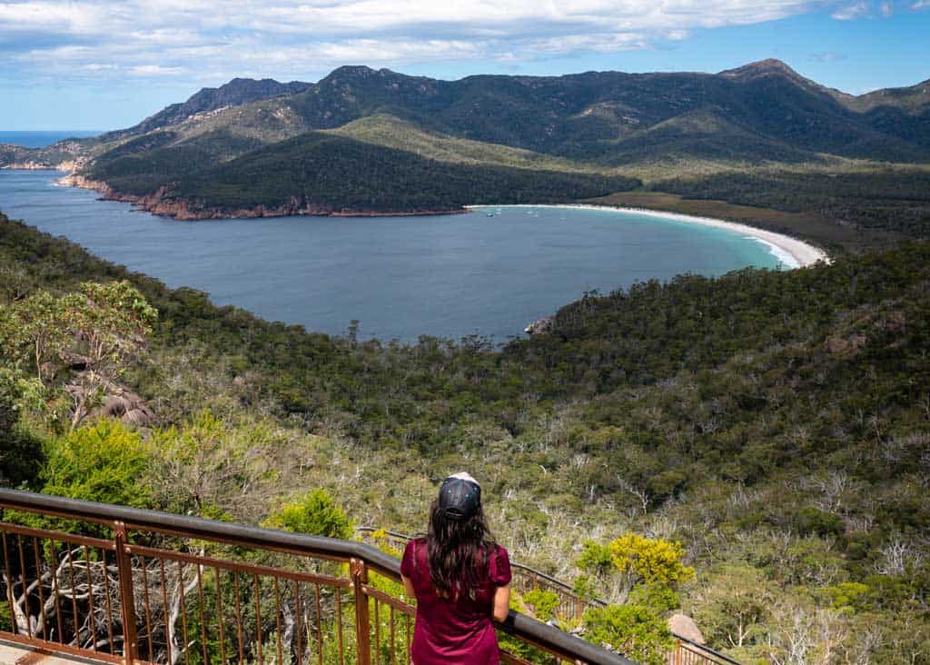
Table of Contents
Wineglass Bay Walk and Hazards Beach Circuit Hiking Guide
- Time Required: 4 to 5 hours
- Distance: 11km
- Difficulty: Intermediate
- Start / Finish Points: Wineglass Bay Car Park
If you love spectacular views, one hike you shouldn’t miss while visiting the area is the Hazards Beach to Wineglass Bay Walk, maintained by Tasmania Parks and Wildlife Service.
The stunning 11km circuit takes about 4 – 5 hours walking depending on your fitness levels (and how much time you spend at Wineglass Bay beach), and can be done either clockwise or anti-clockwise.
Check out video on the walk!
Doing the hike clockwise from the Wineglass Bay Car Park, you head uphill on the Wineglass Bay Lookout Walk and then follow the stairs down to the magnificent Wineglass Bay Beach.
From the beach you follow the trail through the bush, over the isthmus and pop out at the point on Hazards Beach.
Continue along to the end of the beach, follow the signs back onto the path then climb up and around the rocks on Mount Mayson to reach the Coles Bay side then back to the car park.
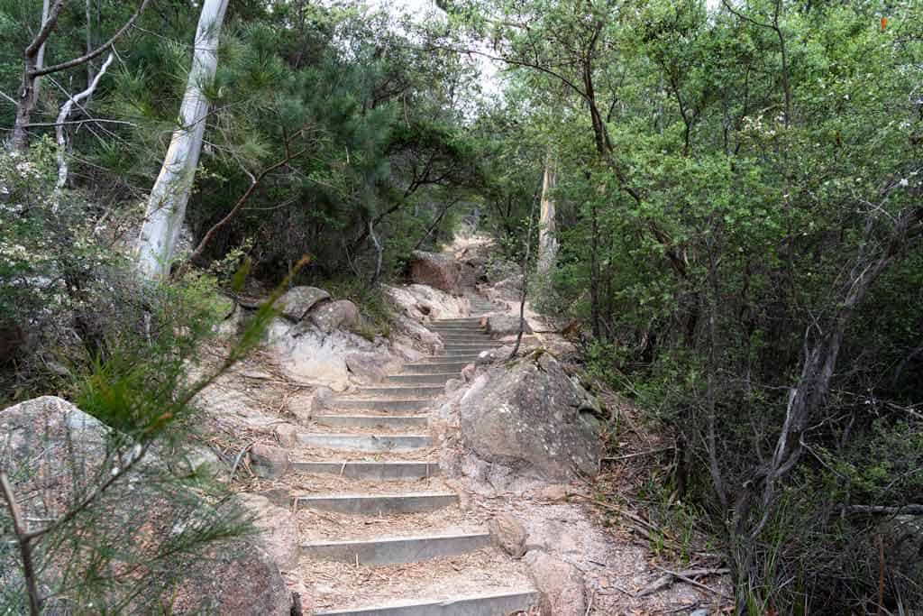
Hiking anti-clockwise you follow the same Wineglass Bay track, first going around the coastal edge near Coles Bay, rock hop down to Hazards Beach, across to Wineglass Bay and then up the steep set of stairs to the lookout.
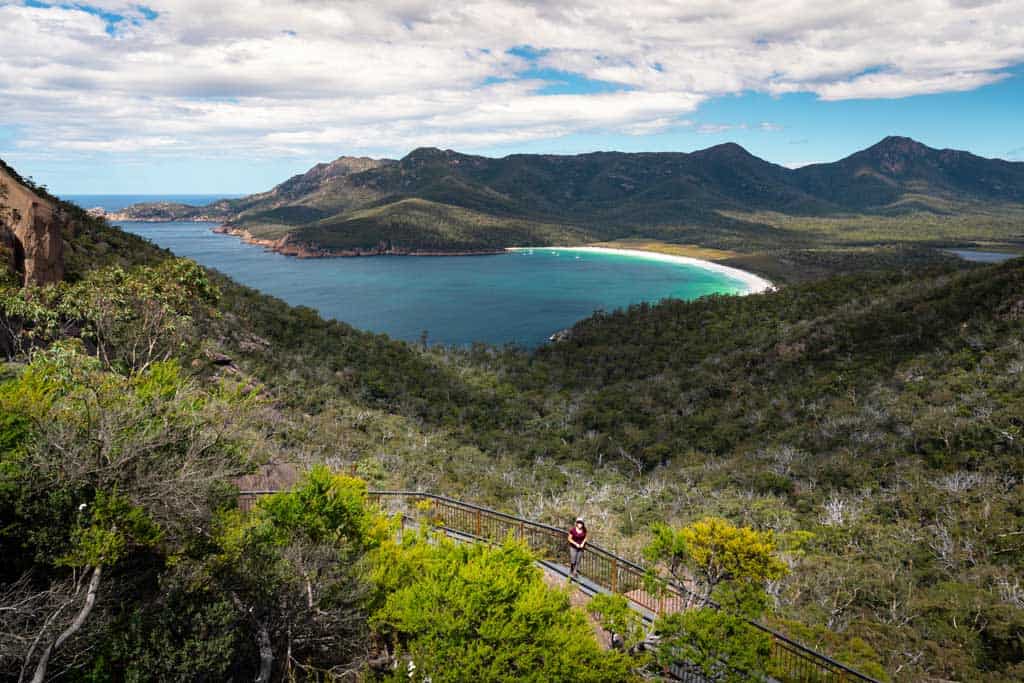
From here you get that iconic view down to Wineglass Bay and across to Mt Graham, then it’s a short walk down to the car park.
Personally we recommend doing the Wineglass Bay Walk and Hazards Beach Circuit in an anti-clockwise direction, finishing at the Wineglass Bay Lookout before the short return to the car park.
It does mean having to climb the steep steps to the lookout though, so if you struggle with ascents, consider going clockwise.
Now that you know the logistics of the hike, here’s what you can expect.
The highlight of the trail is obviously going past the Wineglass Bay Lookout and getting to explore the wide, gorgeous beach at Wineglass Bay itself.
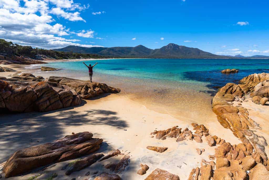
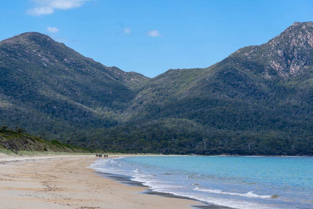
The full 11km circuit also takes you to some of the quieter parts of Freycinet National Park though, including the bushland across the isthmus between Mt Amos and Mt Graham, and towards the wonderful sea at Hazards Beach, with some of the nicest water you’ll ever see.
Whether it’s at Wineglass Bay Beach or Hazards Beach, make sure you bring your swimmers and go for a dip in the sea (although any time between April and October the water gets pretty cold).
At the very least take your shoes off, dig your feet in the sand and perhaps have a picnic on one of Australia’s most picturesque beaches, surrounded by granite peaks.
It really is one of the best things to do in Tasmania.
Not to be forgotten, the sandy walk over the wide isthmus is also tremendously pretty, with lots of native flora and fauna blooming and an earth smell drifting through the trees.
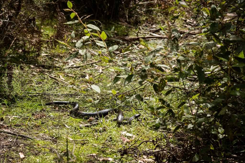
Do watch out for snakes though, and be careful with your footing.
We spotted a large tiger snake just past the isthmus coming into Wineglass Bay, basking in the sun just a few metres from the trail.
He was more scared of us than we were of him, but it definitely made us stop in our tracks!
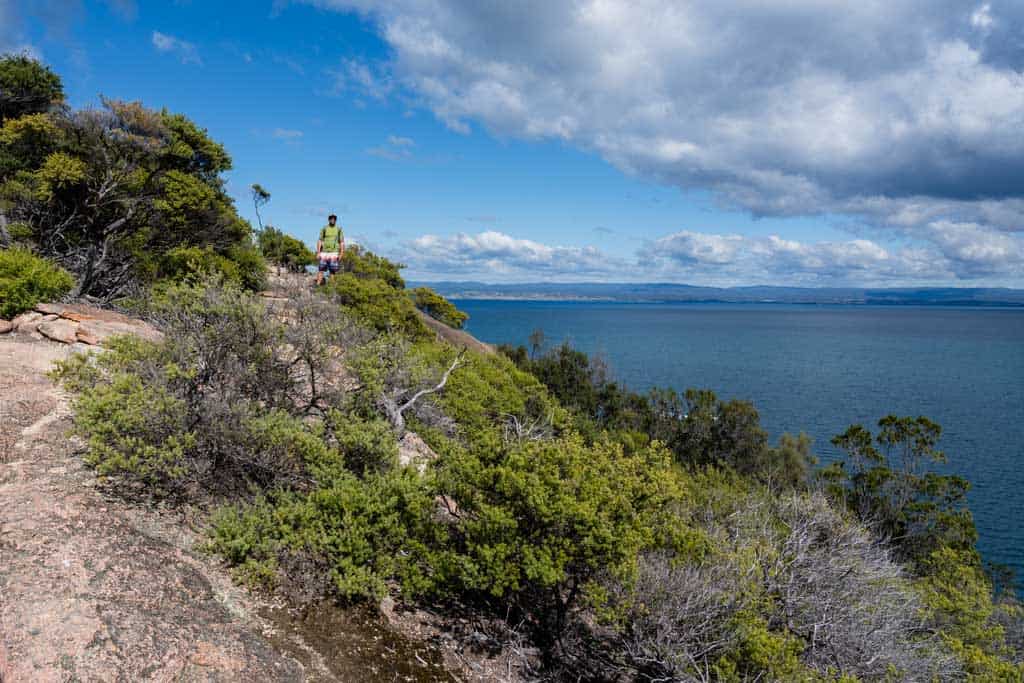
The views along the route are spectacular, especially from the Wineglass Bay Lookout, but the low rocky coastline and cliffs looking out to Great Oyster Bay and Coles Bay in the national park are also worthy of a few photos.
The walk to Wineglass Bay Beach when coupled with the Hazards Beach Circuit showcases some of the best, easily accessible, parts of the Freycinet National Park, and we highly recommend for people of all ages with a reasonable fitness level.
Trail Conditions
As Wineglass Bay is a popular walk in Freycinet National Park, this trail is well marked and well maintained. You can clearly see where the trail goes, and you won’t get lost.
The steps from Wineglass Bay Lookout down to the beach are steep and can be exhausting if climbing them, but they are not difficult.
The path over the isthmus and into Hazards Beach can be sandy and slippery when wet. Watch your footing here.
READ MORE: Enjoy the walking in this park and elsewhere in the state in our comprehensive guide on how to spend 2 weeks in Tasmania!
Facilities on the Hazards Beach and Wineglass Bay Beach Walk
If you need to use the bathroom on the trail your only option is a drop toilet at Wineglass Bay Beach.
There are no facilities at Hazards Bay and Wineglass Bay Lookout in Freycinet National Park.
There is a new, clean toilet block at the car park.
What You Need to Bring for the Wineglass Bay Beach and Hazards Beach Circuit
As it’s just a short walk at 11km at a moderate grade of difficulty, you don’t need to bring a lot with you.
Here’s what we recommend:
- Comfortable day pack
- Supportive walking shoes
- Comfortable walking clothing, pants/shorts and a shirt
- Water (at least 1.5lt per person)
- Sunscreen
- Hat
- Sunglasses (we love Sungod glasses)
- Snacks or Lunch
- Bathers to swim in the crustal clear sea
- Towel
- Rain jacket (just in case)
- Camera
History of Freycinet and Wineglass Bay
The Toorernomairremener people and Tasmanian Aborigines are the traditional custodians of this land, and they called this region home for over 30,000 years.
With modern history since European settlement, the area around the Freycinet Peninsula has been turbulent and tragic however.
Many people believe that Wineglass Bay Beach got its current name due to the shape of cove.
Sadly, this is not the case, and the history of the area hasn’t always been so beautiful.
Since the early 1800s, this area was a major whaling hub, and whalers used to round up these beautiful creatures and push them into the bay, where they would be brutally slaughtered.
To the fisherman who would stand at the lookout, the bay below them would turn red because of all the blood.
So many whales were killed that the colour of the water looked like a glass of red wine. And that’s how Wineglass Bay got its name.
Thankfully the industry came to an end in the 1840s, and the area was reserved as a national park in 1916 (along with Mt Field National Park) to protect the local flora and fauna.
The whales are now slowly returning to the area, but not in the same numbers as previously seen.
READ MORE: Check out our list of the other best places to visit in Tasmania!
Getting to Wineglass Bay in Freycinet National Park
It takes about 3-4 hours to drive to Freycinet National Park from either Hobart or Launceston.
Wineglass Bay is located at the southern end of the national park, and the day walks around here, including Mt Amos, Mount Graham, Wineglass Bay Lookout and the Hazards Beach Circuit, as well as the big multi-day trek, all leave from the same car park just past the visitors centre when you drive through Coles Bay.
From the Coles Bay car park it’s less than one hour return to the lookout, 2 hours and back to the beach, and 4-5 hours return for the entire circuit.
The best way to get around is to rent a car and explore on your own! We recommend Rental Cars, which has the largest range of vehicles for the best value on the market.
Where to Stay in Freycinet National Park
There are a few options for accommodation along the Freycinet Peninsula, and if you’re travelling in peak season or school holidays you do need to book ahead.
Accommodation in Freycinet National Park
Accommodation in the Freycinet National Park and Coles Bay are some of the more expensive options in Tasmania, especially if you’re trying to travel on a budget.
Here are our recommendations. Remember to pre-book online as far ahead as possible, especially in the summer.
Budget
The BIG4 Iluka Holiday Centre is the best choice for value in Coles Bay. It’s a 2 minute walk from the sandy beaches of Coles Bay.
Mid-Range
If you’re travelling as a couple or with your family, have a look at Acacia Cottage and Mayson Holiday House.
Luxury
If you want to stay in one of east coast Tasmania’s best retreats, don’t miss out on Saffire Freycinet. Located in the heart of Coles Bay road, you are so close to all the attractions and your stay is absolute luxury.
Camping in Freycinet
If you’re planning on camping in the national park, whether in a motorhome or tent, you need to get in early.
You’ll find limited sites at the national park campground, and the powered ones get booked up months in advance.
Ring the information centre on (03) 6256 7000 or email freycinet@parks.tas.gov.au to make a booking.
Not too far up the road is the gorgeous Friendly Beaches campground as well, but if you stay here you have a bit of a drive to do.
Check out our guide on camping in Tasmania while you’re in the state too to help you make the most of your trip.
We hope you found our Wineglass Bay and Hazards Beach Walk guide useful. If you did, leave a comment below and let us know what your favourite part of walking the track was. For us, it was swimming in the sea and the view from the top.
DISCLAIMER: Some of the links in this article are affiliate links, which means if you book accommodation, tours or buy a product, we will receive a small commission at no extra cost to you. These commissions help us keep creating more free travel content to help people plan their holidays and adventures. We only recommend the best accommodations, tours and products that ourselves or our fantastic editorial team have personally experienced, and regularly review these. Thanks for your support, kind friend!

1 thought on “Wineglass Bay Walk and Hazards Beach Circuit Hiking Guide”
Wineglass Bay was named by Tobias Furneaux on the 17/3/1773 when he sailed up the east coast of Tasmania. Well before bay whaling had started.