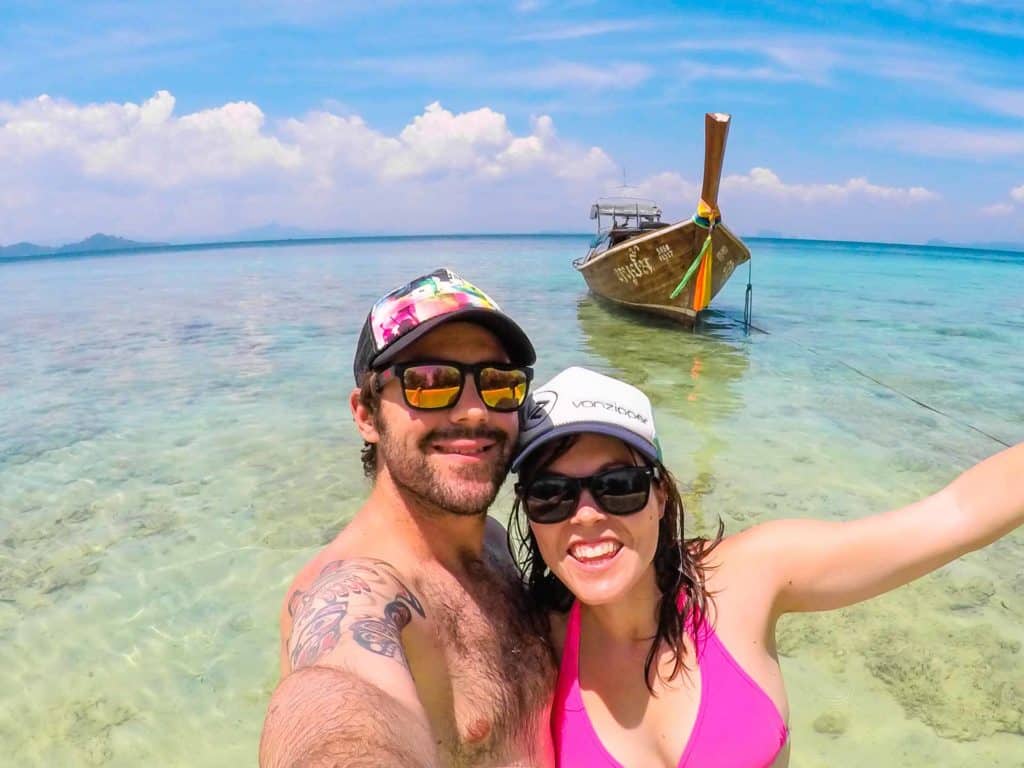
Welcome to our comprehensive guide to the best Royal National Park walks, filled with the local advice, tips and information to help you make the most of your next Sydney hiking trip!
The Royal National Park is located just 45 minutes south of Sydney, and is the most popular park in all of Australia.
It was established in 1879, making it not only Australia’s oldest national park, but the second oldest in the entire world (after Yellowstone in the USA).
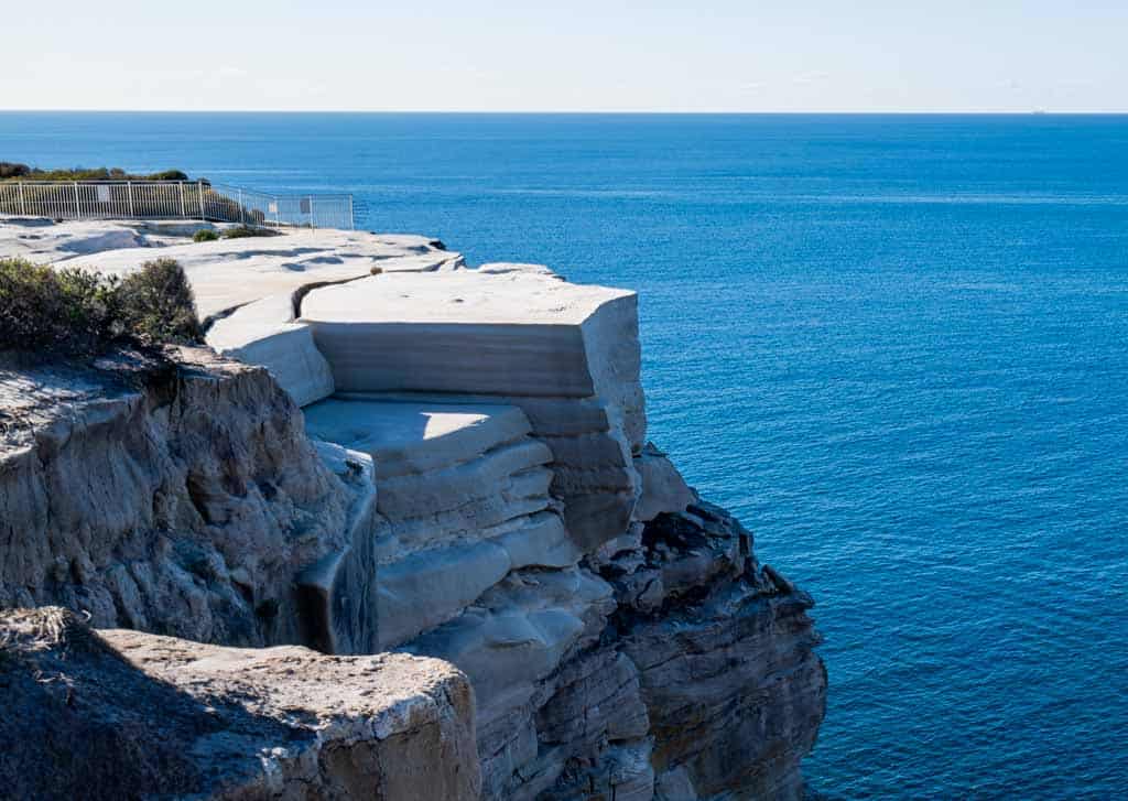
With over 15,000 hectares of protected land, from jaw-dropping coastal cliffs, isolated beaches, stunning waterfalls, dense native bush and picturesque swimming holes, there really is something for everyone in the Royal National Park.
If you’re an active person you’re in luck, because the Royal National Park is also home to some of the best walks in Sydney.
With easy access from the CBD, you can get here by public transport, or if you have your own vehicle, there’s lots of parking available wherever you want to explore.
Whether you live in Sydney or are just here on a holiday, we highly recommend you visit the Royal National Park to bask in some of the state’s most incredible coastal views.
READ MORE: Click here to read our ultimate Australia travel guide!
In this article we’ll dive into the best Royal National Park walks, from short trails to the legendary multi-day hike, the Royal Coastal Track.
We’ll also share tips on how to get to Royal National Park from Sydney or other nearby towns, when to visit and where you can camp here.
Our guide to the best Royal National Park walks includes:
- The Coast Track – 26km One-way
- Bundeena to Jibbon Head Loop – 6.8 Loop
- Jibbon Beach Loop Track – 5km Loop
- Bundeena to Big Marley Head – 10.8km Loop
- Bundeena to Little Marley Beach – 14km Return
- Loftus to Bundeena via Winifred Falls – 18.5km One-way
- Audley to Gibraltar Rock – 2.2km Return
- Uloola Walking Track, Audley to Waterfalls- 11km One-way
- Robertson Roundabout – 2.3km Loop
- Engadine Track, Engadine to Audley – 5.6km One-way
- Wattamolla Picnic Area to Wattamolla Dam – 1.7 Return
- Wattamolla to Little Marley Beach or Big Marley Beach – 10.4km Loop
- Wattamolla to Eagle Rock and Curracurrong Falls – 7.4km Return
- Providential Point – 1.6km Return
- Wattamolla to Garie Beach – 7.6km One-way
- Karloo Walking Track – 10km Return
- Heathcote to Engadine Loop – 15km One-way
- Couranga Walking Track – 9.8km Return
- Otford to Figure Eight Pools Loop (Palm Jungle Loop)- 13.4km Return
- Otford to Helensburgh via Burning Palms- 14.1km One-way
Let’s get into it!
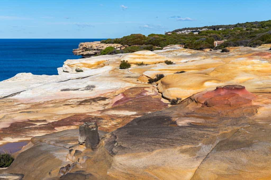
Table of Contents
- The Best Royal National Park Walks
- Best Time to Visit Royal National Park
- How to Get to Royal National Park
- Royal National Park Fees
The Best Royal National Park Walks
There are so many beautiful Royal National Park walks, and we have broken them down into where they are located.
This way you’ll be able to figure out which hiking trails you’d like to do, based on where you’ll be starting from in the Royal National Park.
Hikes from Bundeena
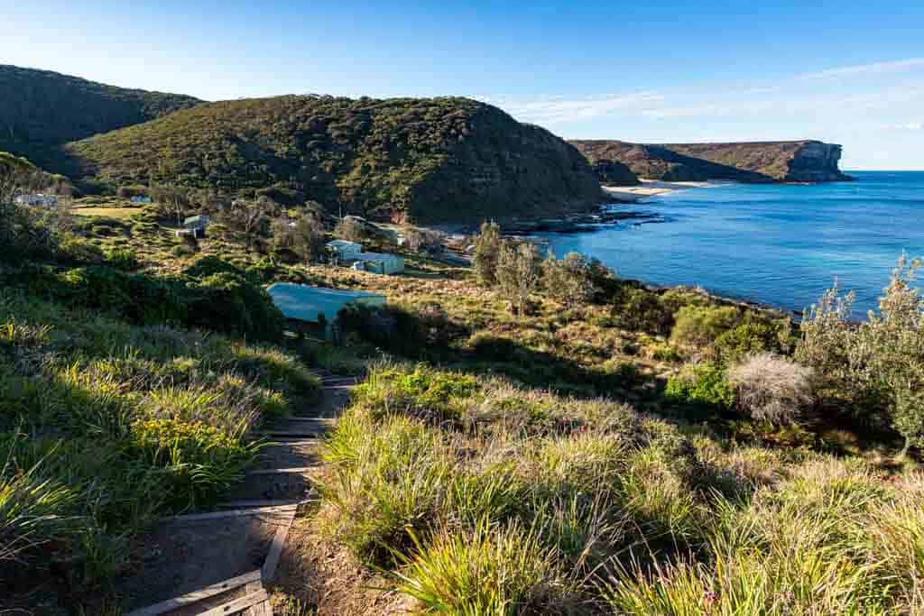
Bundeena is a gorgeous little coastal town located at the northern end of the Royal National Park.
Many Royal National Park walks begin here.
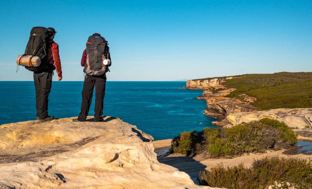
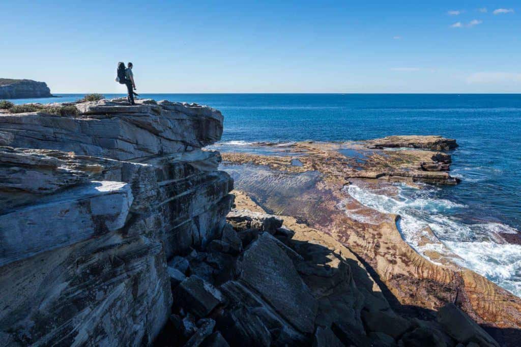
The Royal Coast Track (Bundeena to Otford)
- Time: 2 days (one big day if you’re very fit)
- Distance: 26km one-way
- Difficulty: Moderate-Hard
- Camping Spot: North Era Campground
- Start / Finish: Bundeena to Otford (or reverse)
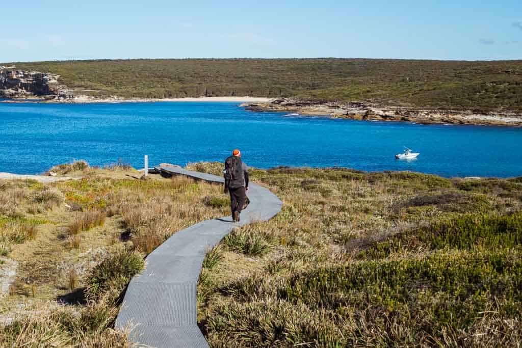
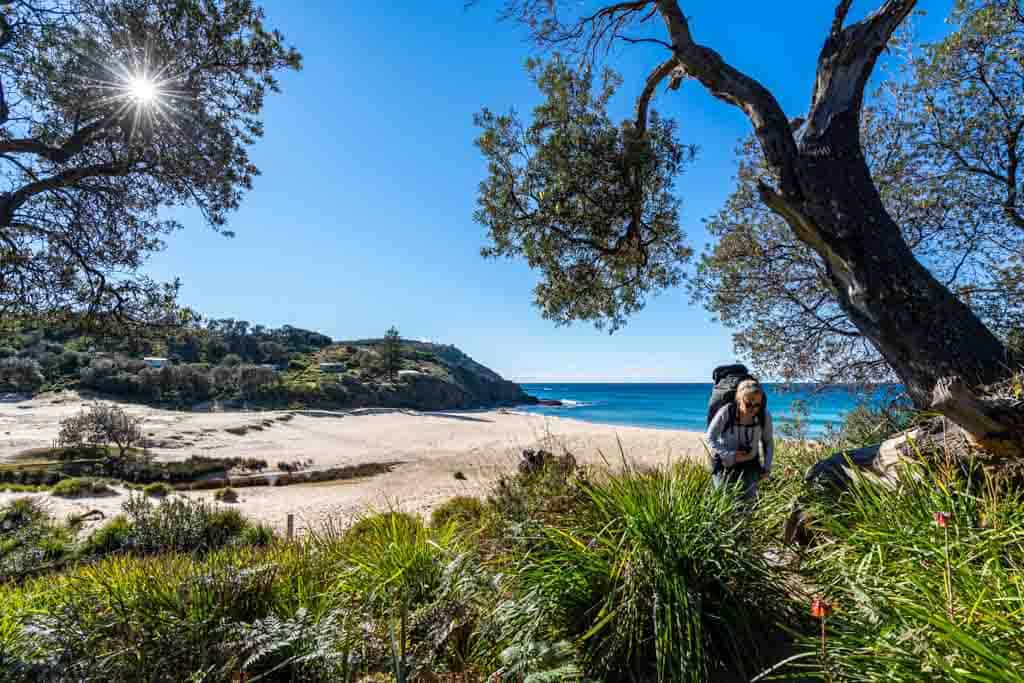
This is the big one – The Royal National Park coastal track is an epic multi-day trek between the towns of Bundeena and Otford.
The trail is 26km and will take 2 days to do it. You can pitch your tent at North Era Bush Campground, 18km from Bundeena (advanced bookings are necessary).
You can do the hike in either direction, but we personally recommend doing it from Bundeena to Otford, so you get the bulk of it out of the way on the first day.
The walk follows the coast giving you awesome views at a bunch of different lookouts.
The highlights include Wedding Cake Rock and the Figure 8 Pools, but for us the best part was spotting migratory humpback whales just off the cliffs.
Do the hike between May and October to time it with the whale season.
There is public transport to Bundeena and Otford, so you can easily do the Royal Coast Track from Sydney.
Take the train from Central Station to Cronulla, then jump on the ferry to Port Hacking.
Once you finish in Otford there is a station there to let you take a train straight back to the city.
Bundeena to Jibbon Head Loop
- Time: 3 hours
- Distance: 6.8km loop
- Difficulty: Moderate
- Start / Finish: Bundeena
This 6.8 km loop walk follows the coast and takes you to secluded beaches, aboriginal carvings, and rock shelves.
This easy walk starts at the ferry wharf in Bundeena and goes towards Jibbon Head, Port Hacking Point and Shelley Beach.
If you are keen you can do a short side hike off to Bundeena Lookout.
Jibbon Beach Loop Track
- Time: 2 hours
- Distance: 5lm loop
- Difficulty: Moderate
- Start / Finish: Bundeena
This hiking trail in the Royal National Park is similar to the above. But instead of going in a triangle loop, you follow the coastline from Bundeena to Jibbon Head.
Once you get to Jibbon Head you will head down to Shelly Beach and hit an intersection. Head inland towards Bundoora.
You will meet up with the path you walked out of town on.
READ MORE: Travelling north? Don’t miss out on the best Warrumbungles walks if you love adventure and hiking trails!
Bundeena to Big Marley Head – 10.8km Loop
- Time: 3 hours
- Distance: 10.8km loop
- Difficulty: Moderate
- Start / Finish: Bundeena
This Royal National Park walk leaves from town and heads south towards the Bundeena Lookout.
From there you follow the coastline south with beautiful views and interesting rock formations, along part of the Royal Coast Track.
Don’t forget to look out for the whales if you’re here in winter.
Some of the highlights include Wedding Cake Rock, the Balconies and the Waterrun. All are famous sights in the Royal National Park.
Eventually you’ll hit an intersection where you can take an inland trail back to Bundeena. Don’t worry,
You will hit the interaction where you can take an inland trail back to Bundeena.
Don’t worry, there’s plenty of signs along the way.
Bundeena to Little Marley Beach – 14km Return
- Time: 6 hours
- Distance: 14km return
- Difficulty: Moderate
- Start / Finish: Bundeena
This is a great walk if you’re looking for a Royal National Park day trip and want to catch the ferry across from Cronulla.
From town you walk out to the Bundeena Lookout then head south along the coastline past the Balconies and the Waterrun.
Take some snacks and have a swim when you get to Little Marley Beach.
You will hit Marley Beach first and Little Marley Beach is passed that. You can retrace your steps and return on the same track or take an inland trail which will head back to Bundeera also.
READ MORE: Check out our list of the best day trips from Sydney
Walks from Loftus
Loftus is at the northwestern end of the Royal National Park, and has a train station connecting it with Sydney.
Loftus to Bundeena via Winifred Falls – 18.5km One-way
- Time: 8 hours
- Distance: 18.5km loop
- Difficulty: Moderate
- Start / Finish: Loftus to Bundeena
This track starts from Loftus Railway Station, and is a great one to do if you’d like to check out some waterfalls. Follow the Honeymoon Track towards Audley.
You will pass over Artillery Hill to reach Winifred Falls. From there you continue on past Anice Falls.
After Anice Falls, you keep following the Southwest Arm of the Port Hacking and you will reach Bundeena.
If you have time, stay a night in Bundeena and do some of the hikes around there, or jump on the ferry to Cronulla then the train to Sydney.
Rather return to Loftus? Just walk to the falls and head back the same way.
Hikes from Audley
To get to Audley in the Royal National Park, you’ll need your own vehicle (or take the shuttle bus from Sutherland). Drive down to Loftus then take Audley Road towards the boatshed.
Alternatively, you can hike about 5km from Loftus Station to get to the Audley Visitors Centre. Just watch out for cars along the road.
Audley is the perfect spot to drive to if you have kids and just want to check out some of the easier Royal National Park walks, as there is a picnic area and toilet block.
Audley to Gibraltar Rock
- Time: 1 hour
- Distance: 2.2km return
- Difficulty: Easy
- Start / Finish: Audley
Start from the Audley picnic area and dance hall to enjoy this great easy stroll following the Hacking River.
Walking south you will follow the old Lady Carrington Drive trail and you will hit Gibraltar Rock, which is a large overhanging piece of sandstone.
Walk back the same way to get back to Audley.
Robertson Roundabout
- Time: 1 hour
- Distance: 2.3km loop
- Difficulty: Easy
- Start / Finish: Audley
This is a nice short loop walk leaving right from Audley.
You cross the Hacking River behind the visitors centre and hike up the hill to get you on a ridge.
Up here you will see beautiful views of the Hacking River and surroundings.
Follow the signs and it will loop you back around to the visitor centre along the forest path.
Uloola Walking Track
- Time: 5 hours
- Distance: 11km one-way
- Difficulty: Moderate
- Start / Finish: Audley to Waterfall
This 11km one-way track goes via the beautiful waterholes and rock flats at Karloo Pools.
If you continue past the pools you will come across a campsite at Uloola Falls. You can stay the night and break up the hike, or continue walking.
To keep going follow the service trail towards the Waterfall Railway Station.
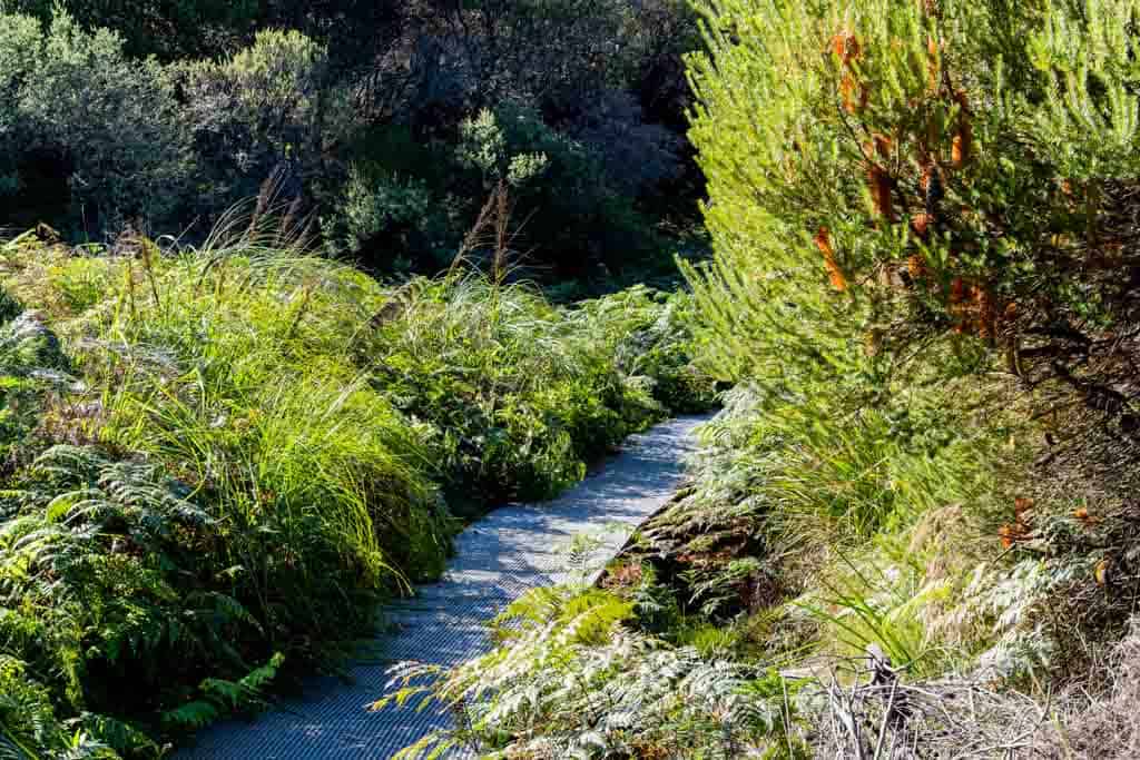
The forest path follows the ridgeline with beautiful views and fascinating sandstone formations.
In the warmer months, you will see beautiful wildflowers along the walk. Keep your eye out for mountain bikers as this is a popular trail for this activity also.
See the details below about the Uloola Falls Campsite. You can also hike the trail in reverse, from Waterfall to Audley.
Hikes from Engadine
Ther next town (and train station) past Loftus is Engadine, a great spot to check out another of the great walks of Royal National Park.
Engadine Track
- Time: 3 hours
- Distance: 5.6km one-way
- Difficulty: Moderate
- Start / Finish: Engadine to Audley
From Engadine Railway Station, you will walk east through light scrub and start heading towards Audley.
You will pass Tuckawa Rill Creek and small rock pools to end with great views of Hacking River.
The forest path ends at Audley Visitors Centre. You can walk back to Engadine if you want, or walk/hitchhike to Loftus.
Walks from Wattamolla
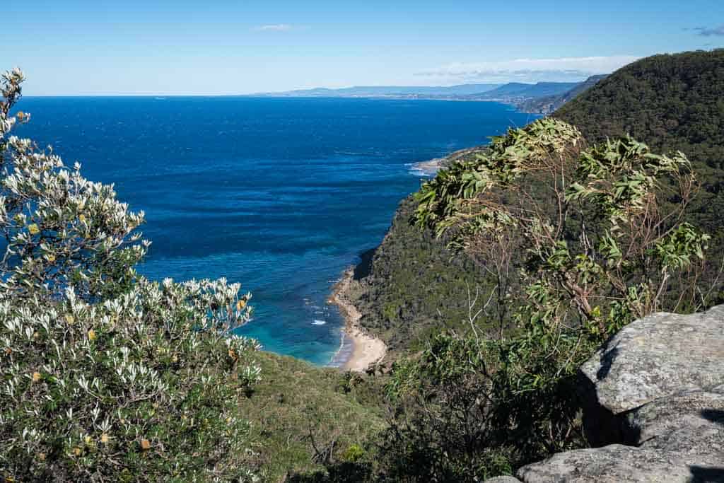
Wattamolla is perhaps the best place to check out some of the Royal National Park beaches, waterfalls and hikes thanks to its central location.
There’s no public transport unless you want to take the shuttle bus from Sutherland station. There’s a lot of parking here though and great facilities.
Even if you’re not hiking, Wattamolla is a popular spot in the Royal National Park for picnics and cliff jumping.
Wattamolla Dam Walk
- Time: 45 minutes
- Distance: 1.7km return
- Difficulty: Moderate
- Start / Finish: Wattamolla Car Park
Starting in the car park in Wattamolla, you follow the windy “Coast Track” north.
After a short walk, you will come across the Wattamolla Dam. The dam joins the Wattamolla River and there is a small waterfall.
This is a great walk for kids and who struggle with long-distances.
Don’t forget to bring your bathers and take some lunch for a picnic in the Royal National Park.
Wattamolla to Little/Big Marley Beach
- Time: 5 hours
- Distance: 10.4km loop
- Difficulty: Moderate
- Start / Finish: Wattamolla car park
This track can be added on after you reach Wattamolla Dam. It starts from the Wattamolla car park and heads north on the Coast Track.
You will be rewarded with spectacular views of the Royal National Park coastline as you make your way to Little Marley Beach.
You can stop there for a swim or continue on to Big Marley Beach. When returning you can take an inland trail or follow the same track back to Wattamolla.
If you do take the inland trail, the intersection is between the two beaches. Then follow the signs towards Wattamolla.
Wattamolla to Eagle Rock and Curracurrong Falls
- Time: 3 hours
- Distance: 7.4km return
- Difficulty: Moderate
- Start / Finish: Wattamolla Car Park
This Royal National Park hike starts at the car park also. Head south from Wattamolla along the Coast Track and follow the coastline.
The trail winds in and out of native vegetation by the ocean and inland.
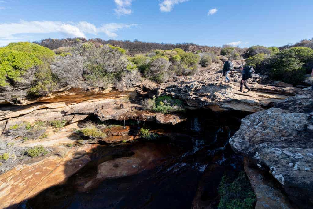
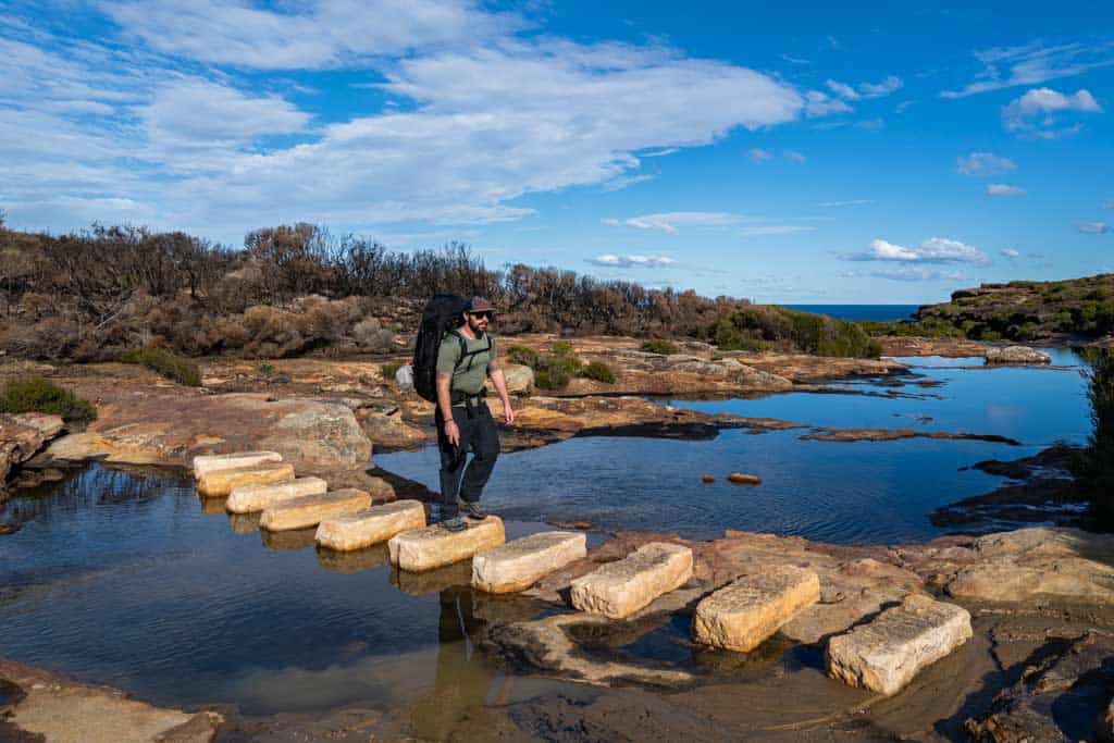
After a bit of time you will hit Curracurrang Cove and cross the gully until you hit the Curracurrang Creek.
There are stepping stones to cross here. The path will head up a hill and Eagle Rock will become visible. You will eventually hit the Eagle Rock Lookout.
There are signs along the track, and as a general rule keep the ocean on your left.
Curracurrong Falls is very fascinating and one of the nicest Royal National Park waterfalls.
If you are there in the wet season this waterfall is quite impressive.
Providential Point – 1.6km Return
- Time: 1 hour
- Distance: 1.6km return
- Difficulty: Moderate
- Start / Finish: Wattamolla Car Park
This is another walk that leaves from the Wattamolla car park. From the men’s toilets follow the signs for Providential Point.
As you follow the trail you will pass through an open grassy field and follow the coast to see gorgeous views of Presidential Cove.
You will pass the Providential Point campsite and head to the lookout.
Wattamolla to Garie Beach – 7.6km One-way
- Time: 4 hours
- Distance: 7.6km one-way
- Difficulty: Hard
- Start / Finish: Wattamolla to Garie Beach
This track is the hardest from Wattamolla car park, and heads south along the Coast Track.
Make sure you’re prepared with water and food, as it can take you quite a few hours, especially if you decide to make it a 15.2km return hike.
The trail offers great views of the sea and the many ledges along the way.
You will follow the top of the sea cliffs before dropping down to Garie Beach, which is patrolled during the summer.
Bring your bathers and have a drip before taking the shuttle bus back, or you can walk to Wattamolla if you’re feeling extra fit.
Heathcote Hikes
Heathcote offers a different view of the top Royal National Park walks, with a couple of long ones worth checking out.
Karloo Walking Track
- Time: 5 hours
- Distance: 10km return
- Difficulty: Moderate
- Start / Finish: Heathcote Railway Station
The Karloo Track is one that is well signed and easy to follow.
Starting from the Heathcote Railway Station you follow the trail east to a beautiful waterhole along Kangaroo Creek.
At the end of the track, you will come across magnificent views from the ridge and can take a dip in Uloola Falls.
So bring your bathers and a snack to enjoy this lovely spot.
Heathcote to Engadine – 15km One-way
- Time: 7 hours
- Distance: 15km one-way
- Difficulty: Hard
- Start / Finish: Heathcote to Engadine
This track is a combination of a few tracks on this list, the Engadine Track and the Karloo Track, and covers a large section of the national park.
It goes from the Heathcote Railway Station to the Engadine Railway Station or you can do it reverse, as there is public transport available at both ends.
You will pass swimming holes, rock pools, waterfalls and great views.
Hikes from Waterfall
The town of Waterfall is another great launch point for hiking in Royal National Park.
Couranga Walking Track – 9.8km Return
- Time: 4.5 hours
- Distance: 9.8km return
- Difficulty: Moderate
- Start / Finish: Wattamolla to Garie Beach
The walk leaves from Waterfalls Railway Station and will take you through to McKell Avenue.
You will join the Uloola Walking Track for the first bit and you will reach an intersection where you head to the right towards McKell Avenue.
You will pass through historic sawpits from the logging days. You will reach Hacking River after walking through beautiful rainforest trees.
The floral diversity is incredible and you will see some of the most diverse ecosystems in the Royal National Park.
If you want to extend your walk, add on the Forest Path Trail.
Hikes from Otford
Otford is a popular place to visit the Royal National Park from, and is especially well known for its proximity to the famous Figure 8 Pools.
Otford to Figure Eight Pools (Palm Jungle Loop)
- Time: 7 hours
- Distance: 13.4km return
- Difficulty: Hard
- Start / Finish: Otford Station
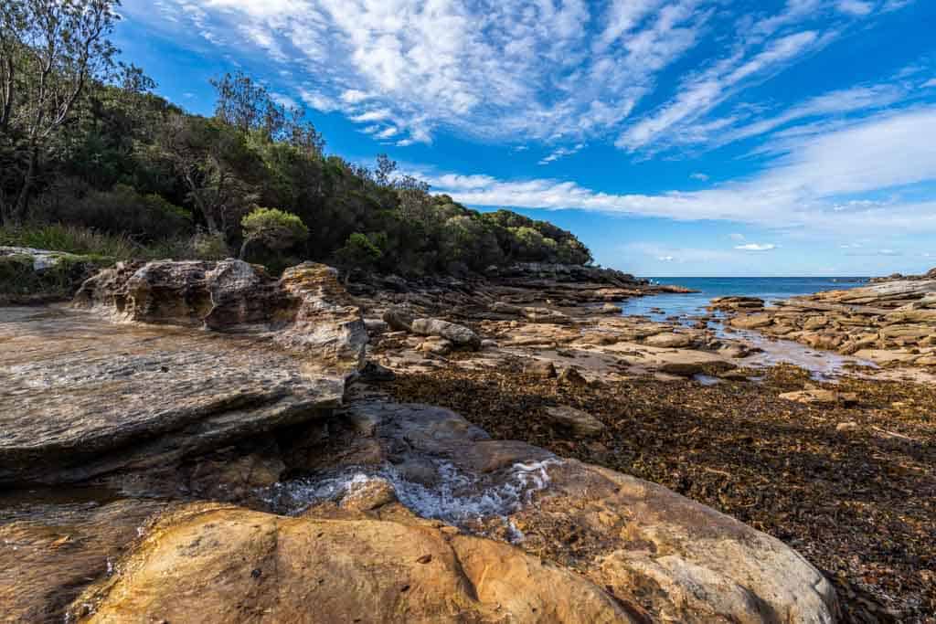
Starting from Otford Railway Station, head north to enjoy the diverse forests and open grasslands along the coastline.
You will pass through Werrong Point, Palm Forrest, Burning Palms Beach, up Bulgo Hill to Garrawarra Ridge and back towards Otford.
Figure 8 Pools will be your highlight, and they are one of Sydney’s’ most Instagrammable spots.
Check the tide reports for the pools, as you don’t want to miss bathing in this amazing place. You can only visit at low tide, as the rock shelf becomes slippery and dangerous at high tide.
This is a great Royal National Park walk from Sydney.
Otford to Helensburgh via Burning Palms Beach
- Time: 7 hours
- Distance: 14.1km one-way
- Difficulty: Hard
- Start / Finish: Otford to Helensburgh
This is another walk between two train stations, so perfect if you’re heading to Royal National Park from Sydney on public transport.
Starting from the Otford Railway Station, follow the coastline up towards the Figure 8 Pools Walk.
The views of the coastline are wonderful before you start making your way inland amongst the forest.
The track winds between Garrawarra and the Hacking River, and passes over the sands of Burning Palms Beach.
You will reach the car park and an intersection where the trail will head west and start going towards Helensburgh.
You do gain some elevation so make sure you have enough water and snacks to keep you hydrated.
Other Royal National Park Walks Only Accessible by Car
These are hikes in the Royal National Park that can only be accessed by car as they are not near the train stations.
Some of them are where the public bus drops you off but you need to know exactly where the bus stops and the times it will be back.
- Bundeena Drive to Marley Walk – 8km Return
- Curra Moors Loop Track – 10km Return
- Curra Moors car park to Garie Beach – 4.4 One-way
- Garawarra Farm Carpark to Figure 8 Pools – 6km Return
- Garawarra Farm to Garie Beach – 3.9km One-way
- Garawarra Farm carpark to Figure Eight Pools – 6km Return
- Garawarra Farm to Garie Beach – 3.9km One-way
- Garie Beach to Eagle Rock – 7.7km Return
- Garie Beach to Garawarra to Burning Palms Circuit – 13.5km Loop
- Garie Beach to Helensburgh (The Burgh Track) – 11km One-way
- Garie Beach to North Era Beach – 3.2km Return
- Garie Road to Era Loop – 5km Loop
- Deer Pools – 3.8km Return
- Forest Island to Calala – 8.9km Return
- Lady Carrington Drive to Palona Cave – 5.1km Return
- Forest Track – 4.4km Loop
- Wallumarra to Palona Cave – 11.8km Return
- Wallumarra Track to Bola Creek – 4.7km One-way
- Wallumarra Track to Forest Way – 12.5km Loop
- Wise Track – 4.4km One-way
- Marley Track – 11km Loop
- Mowlee Ridge to Garie Beach – 13.3km One-way
- Stockyard spur to Garie Beach – 3.3km One-way
- Mt Bass to Winifred Falls – 6.7km Return
Best Time to Visit Royal National Park
The best time to go walking or hiking in Royal National Park depends on what you would like to see and do.
Summer
Summer (December, January and February) is obviously best for swimming and paddling in Royal National Park, but it will be busy as this is Australia’s holiday months.
So plan ahead if you are camping in the park or get there early to get a parking spot.
The park’s beaches and swimming holes in the rivers and creeks will be packed.
Garie Beach is patrolled by lifeguards in the summer so it is a great place to go for families.
Spring
During Spring (September, October, and November) you will come across beautiful wildflowers that are blooming.
The best area to see this is along the Coast Track, Curra Moors Loop Track or Wise Track.
Bring layers during this time as weather can change and get cooler early in the day.
Some days can be rainy so check the weather before heading to the Royal National Park to be prepared.
Autumn
The best time to visit Royal National Park is autumn, from March to May.
The park will be quieter, especially during the week. Weekends will be busy as this is a great getaway for people living around the area.
If you are on the coastal walks and hikes you may spot whales migrating at the end of April and May.
Winter
In the winter months (June, July, and August) is a great time to see humpback whales just off the coast of the Royal National Park.
That being said, the weather for hiking is cold and can be wet or overcast.
If that doesn’t bother you though you’ll be rewarded with empty trails.
The winds along the coast can also be particularly heavy. Make sure you bring waterproof and windproof outerwear.
We personally use and recommend Kathmandu clothing. You can find their gear online or in stores in any of Australia’s major towns.
How to Get to Royal National Park
Getting to the Royal National Park is easy and you have several options.
We will explain to you how to get there on your own transport or taking public transport. All the instructions below are from Sydney CBD.
Car
If you’re driving to Royal National Park, you’ll be able to explore just about anywhere you want.
All of the most popular Royal National Park bushwalks are accessible by car, and you’ll find places to park in Bundeena, Otford, Audley and Wattamolla, as well as in the towns on the main road such as Waterfall, Engadine and Loftus.
The best way to get around is to rent a car and explore on your own! We recommend Rental Cars, which has the largest range of vehicles for the best value on the market.
Ferry
You can catch a ferry from Cronulla Ferry Wharf to Bundeena.
It’s a 20 minute trip across the Hacking River and is a beautiful ferry ride. The Cronulla wharf is a short walk from the Cronulla train station.
You can get the Illawarra line (blue line) to Cronulla from Sydney CBD.
Once you are in Bundeena, it is a 25-minute walk through the village to the walking track entry points.
Check the Transport NSW website for ferry times and more information.
Train
There are regular trains that run every half an hour on weekends and more often in peak times. Take the Blue Illawarra Line from Sydney.
The train will stop at Cronulla, Loftus, Engadine, Heathcote and stopping at Waterfall train station at the southern end of the national park.
If you want to continue onto Otford, take the South Coastline. When you get to the Otford station, it is a 20-minute walk up a steep hill to get to the entry point of the Royal National Park.
This is where the Coast Track will start from if you decide to go from south to north.
The South Coast Line trains run once every hour (every second hour on Sunday) from Central Station in Sydney CBD.
Check the Transport NSW website for train times and more information.
Bus
There is a bus that goes to Royal National Park which runs from Sutherland train station to multiple locations within the park.
The bus fare starts from $9, or an all-day pass is $15.
Do book in advance on weekends and during the holidays as it is busy.
During the week may be quieter and you can pay the bus driver directly.
Bus stops include:
- Sutherland train station
- Otford train station
- Bundeena Wharf
- Audley
- North and south ends of the Coast Track
- Wattamolla
- Garie Beach
- Garawarra Farm car park (the start point for the walk to Figure 8 Pools)
Royal National Park Fees
When entering the park there is a $12 fee per vehicle per day. There are ticket machines at parking lots. Do bring the right change if you want to pay by cash instead of card.
You can buy a 1-year pass or 2-year pass
- All Parks Pass – For all parks in NSW (including Kosciuszko NP) $190 (1 year) / $335 (2 years)
- Multi Parks Pass – For all parks in NSW (except Kosciuszko) $65 (1 year) / $115 (2 years)
- Buy now
Camping in Royal National Park
There are a few spots where you can camp in the Royal National Park.
We highly recommend booking ahead of time as it is a very popular park, and if you don’t have a reservation, you can’t sleep here (no matter how tired you may be).
Book your campsite on the Parks NSW site.
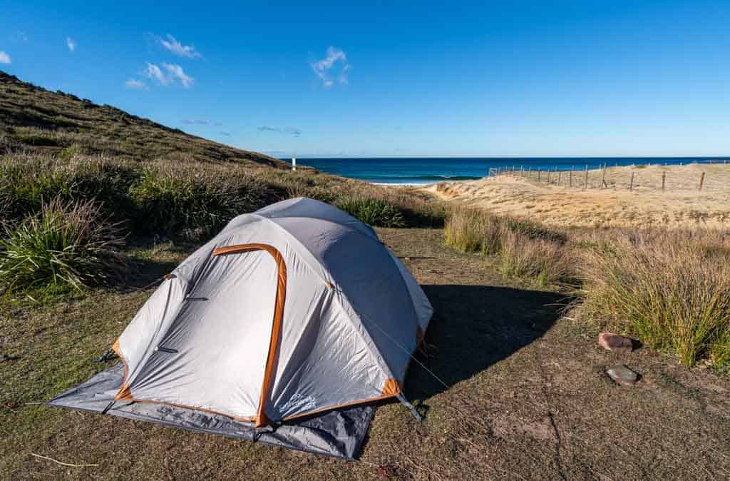
North Era Campground
This is a popular campsite as it is along the Coast Track and is a good stopping point to break up the journey.
It is not accessible by car, only by foot. The campsite is located right on the beach.
There are grass spots, a small sand dune for shielding the wind from the campsites and a drop toilet.
There is no drinking water here so definitely bring enough. It’s a super peaceful and secluded spot in the Royal National Park.
Bonnie Vale Campground
This is the largest campground in the Royal National Park.
It is accessible by car and located between Bundeena and Maianbar. From the nation park entrance in Loftus, it is a 25-minute drive to Bonnie Vale Campground.
It is also a 15-minute walk from the Bundeena wharf. This campground is well set up with 74 sites located in the bush and on the beach, flush toilets, hot showers, drinking water and washing sinks.
There are BBQs available if needed.
Uloola Falls Campground
This campsite is located next to the largest waterfall in the Royal National Park, Uloola Falls.
It is a great stopping point along the Uloola Track. It is only accessible by foot. This campsite connects to Karloo Track.
There is a drop toilet here and space for 6 spots.
Kingfisher Pool Campground
Located 50m away from the tranquil Kingfisher Pool along the Bullawarring Walking Track.
You can only locate this campsite by foot so be well prepared. Campsites are among the bush and there is flowing water.
Do filter the water before using. Continue down the trail and you will see a picnic table and the campground is off to the left.
There is a drop toilet.
Rules for Hiking in Royal National Park
When you are hiking in the Royal National Park please do respect the rules and regulations.
This is so important for our environment and wildlife. In Australia, the temperature can get high, weather is dry and winds can be strong.
This, unfortunately, makes our bushland a high risk of dangerous fires.
In all National Parks in New South Wales, these below are prohibited.
- No campfires and solid fuel burners
- No gathering firewood
- No smoking
- No pets (dogs included)
- No drones, unless you have permission by national parks. Spoiler alert – they will not give you a permit unless you have a commercial reason to be flying there and you complete the application.